
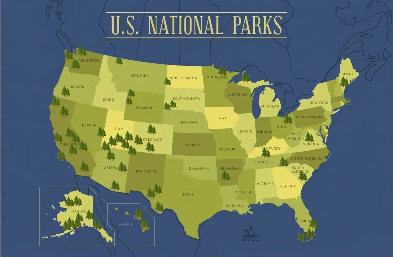
A printable U.S. National Park and State Parks Map is a simple way to see where America’s protected recreation areas are located without relying on a phone or internet connection. Whether you are planning a road trip, studying U.S. geography, creating a travel checklist, or looking for parks near a particular state, a printable map gives you a clear view of the country and its major outdoor destinations.
A good map can show National Parks, state parks, state boundaries, major cities, and geographic regions in an easy-to-read format. It can also be printed at home, placed in a travel folder, used in a classroom, or marked with a pen as you visit different parks.
All US National Parks Map

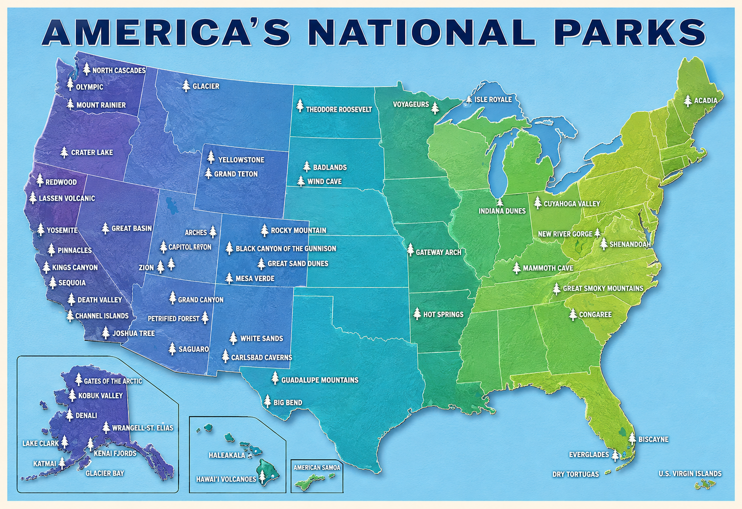
US National Park Map Printable

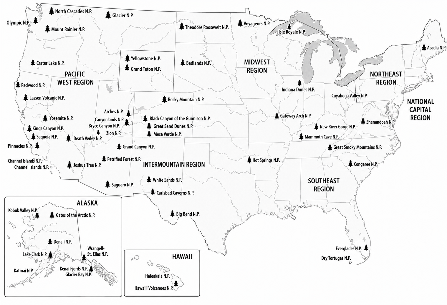
US National Park and State Parks Map Free

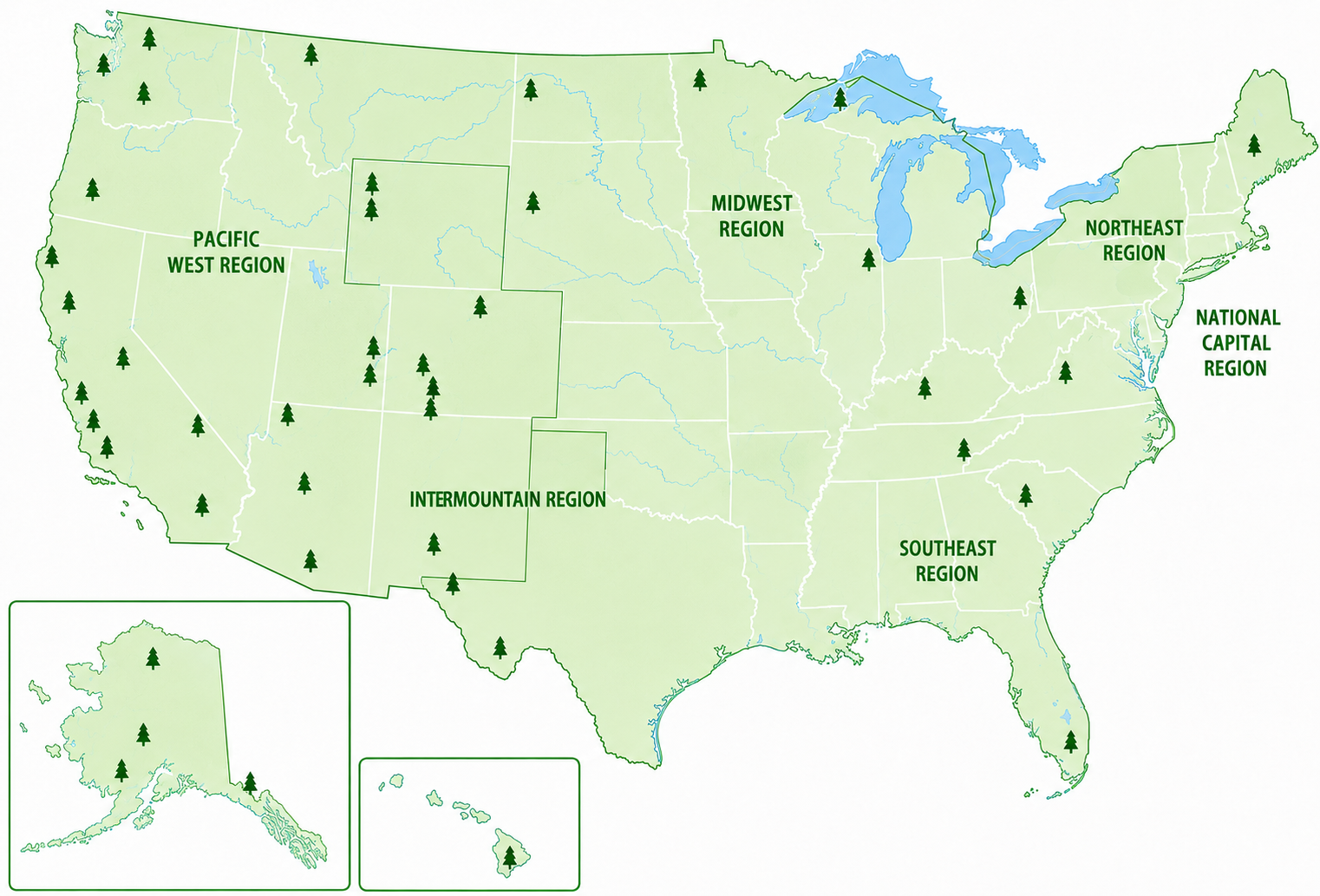
US National Parks Map PDF

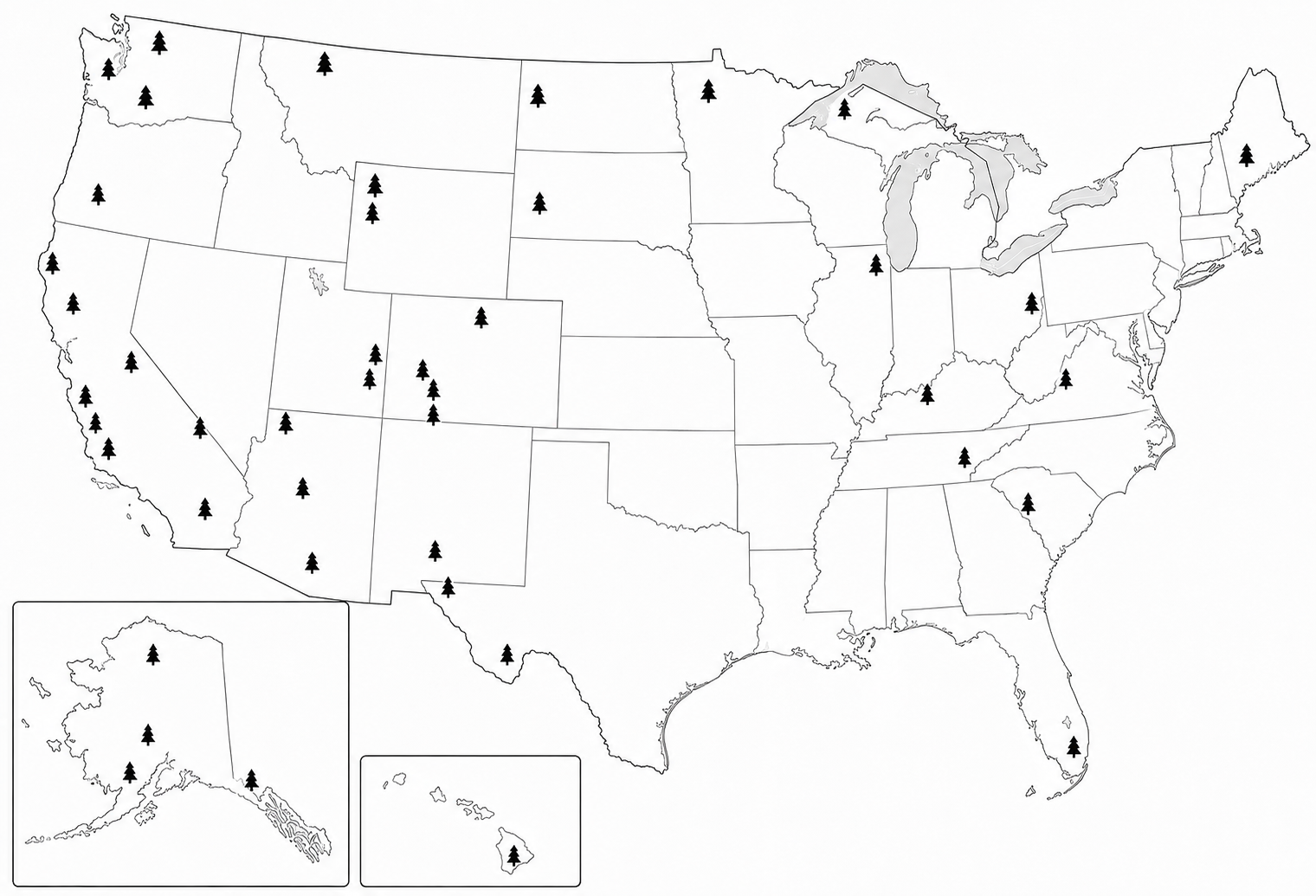
Map of US State Parks

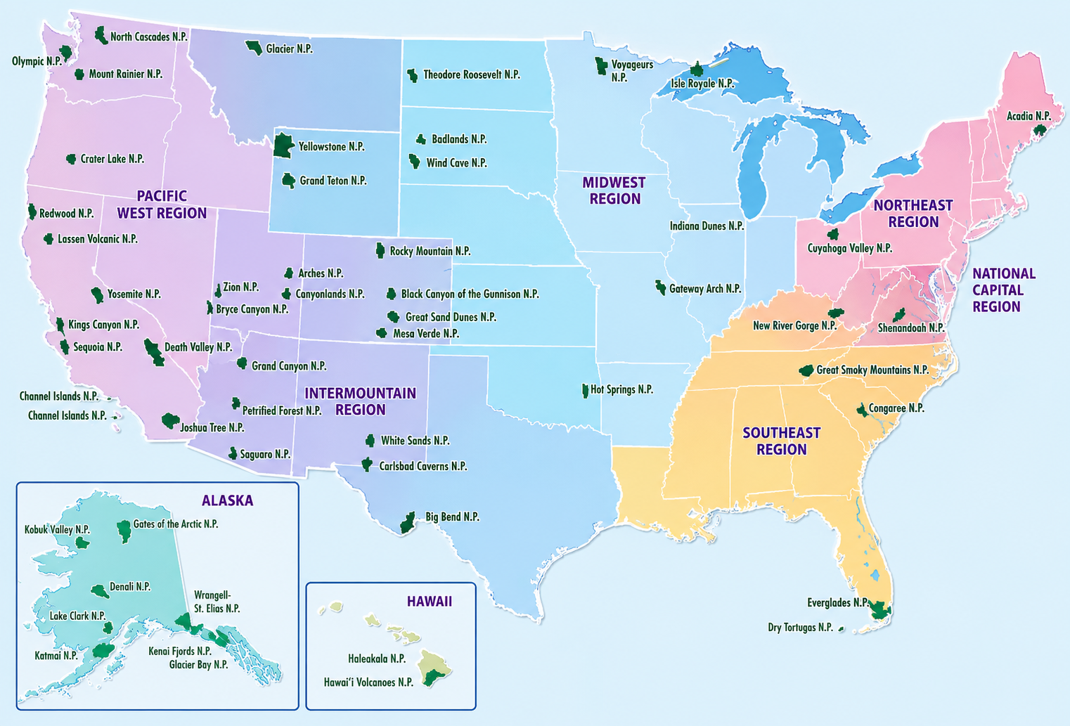
US National Park and State Parks Map PDF


Map of US National Parks

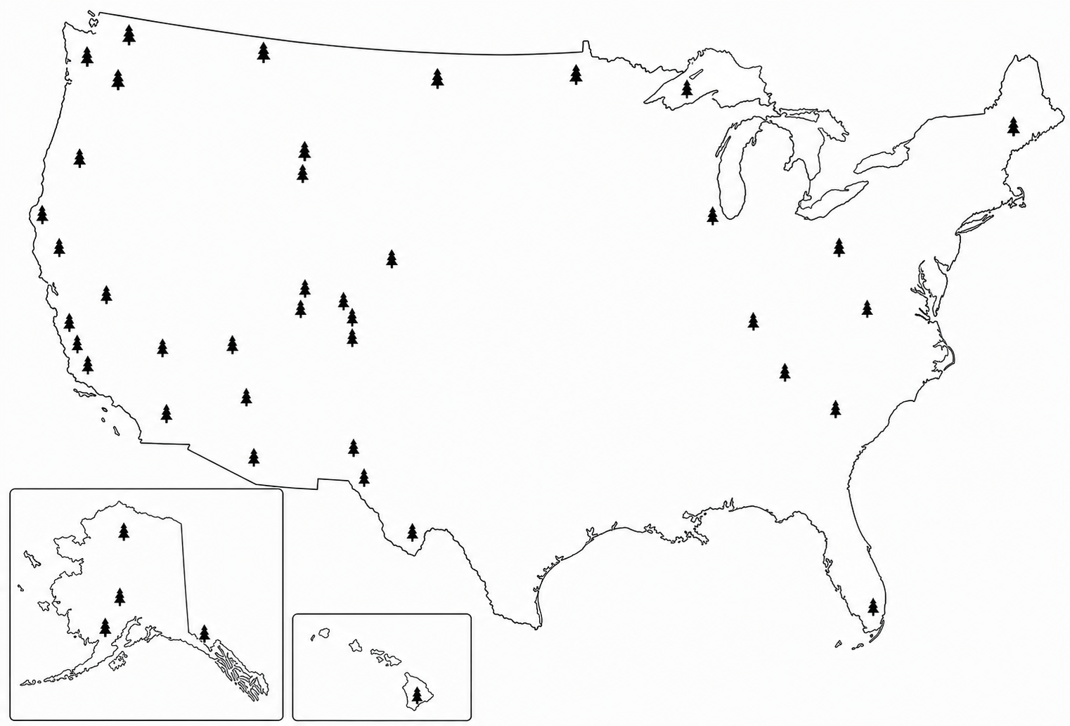
What Is a US National Park and State Parks Map?
A US National Park and State Parks Map is a geographic map that shows the locations of parks across the United States. It combines a national view of the country with markers or labels that identify important protected recreation areas.
National Parks are federally managed units designated by Congress as National Parks, while state parks are established and managed by individual states. These two categories should not be confused because they have different management systems, rules, and purposes.
A printable version is especially useful because it provides a physical reference that can be viewed anywhere. Depending on its design, the map may include:
- National Park locations
- Selected or major state parks
- State boundaries
- State names
- Major cities
- Roads or major highways
- Rivers, lakes, and coastlines
- Park names and symbols
- Alaska and Hawaii in inset sections
- A legend explaining map symbols
Because the United States has a very large number of state parks, a single national map normally highlights selected parks rather than attempting to label every state park.
Also Check:- Blank Map of Western United States Free Download
Why Use a Printable National Park and State Parks Map?
There are several reasons to keep a printable map available when planning outdoor trips.
1. Plan a Road Trip
A physical map makes it easier to understand the overall location of parks. You can mark your starting point, planned destinations, overnight stops, and alternative parks along your route.
For example, someone traveling through the western United States can compare the locations of parks in California, Utah, Arizona, Colorado, Wyoming, Montana, and neighboring states before deciding on an itinerary.
2. Find Parks by State
A U.S. state parks map can help you identify recreation opportunities within or near a particular state. State parks are often useful alternatives when a National Park is crowded, requires reservations, or is farther away.
3. Track Places You Have Visited
A printable map can become a personal travel tracker. Use a pen, sticker, or highlighter to mark every National Park or state park you have visited.
You can also create separate symbols for:
- National Parks you have visited
- State parks you have visited
- Parks you want to visit
- Parks included in your next trip
4. Use It for Education
A printable map works well for geography lessons, homeschooling, classroom activities, and independent learning. Students can learn where major parks are located and connect geography with U.S. states and regions.
5. Plan Trips Without Internet Access
Cell service is not guaranteed in remote outdoor areas. Having a printed overview map provides a useful backup when your phone battery is low or an internet connection is unavailable.
However, a national overview map should not replace detailed park maps, navigation tools, or current travel information.
What Parks Can You Find on the Map?
The U.S. National Park System contains many different types of sites, but a US National Parks Map generally focuses on the 63 places officially designated as National Parks.
These parks are spread unevenly across the country. Western states have a particularly high concentration of National Parks, with states such as California, Alaska, Utah, and Colorado containing several well-known examples.
Some notable parks include:
- Yellowstone National Park
- Yosemite National Park
- Grand Canyon National Park
- Zion National Park
- Rocky Mountain National Park
- Great Smoky Mountains National Park
- Glacier National Park
- Grand Teton National Park
- Olympic National Park
- Acadia National Park
- Everglades National Park
- Joshua Tree National Park
- Death Valley National Park
- Arches National Park
- Bryce Canyon National Park
The geographic location of each park makes a printable map particularly valuable for comparing destinations.
Also Check:- Blank Map of Southeast United States Free Download
National Parks vs. State Parks
One important thing to understand before using a US national park and state parks map PDF is that National Parks and state parks are not the same thing.
National Parks are federally designated and managed as part of the National Park System. They often protect nationally significant landscapes, ecosystems, historical resources, or cultural sites.
State parks are managed by individual states. Their size, facilities, admission policies, activities, and management rules vary considerably from one state to another.
A state can have many state parks but no designated National Park. Therefore, a map showing National Parks alone does not represent all of the outdoor recreation available in that state.
How to Use a Printable Parks Map
Using a printable map is straightforward.
Step 1: Choose the right map size.
Select a full-page map for general reference or a larger format when you need readable park names.
Step 2: Check the legend.
Look at the symbols used for National Parks, state parks, cities, highways, and other features.
Step 3: Locate your starting point.
Find your home, city, airport, or road-trip starting location.
Step 4: Mark your destinations.
Circle the parks you want to visit and identify nearby parks that could be added to your itinerary.
Step 5: Check detailed information separately.
Before traveling, confirm current road conditions, closures, permits, reservations, weather, camping availability, and park alerts.
The printable map gives you the big picture; detailed park information should be used for decisions that depend on current conditions.
When Should You Use a Printable US Parks Map?
A printable map can be useful before, during, and after a trip.
Before a trip: Use it to compare destinations and build an itinerary.
During a road trip, keep it in your vehicle as a quick geographic reference and mark locations as you travel.
For school projects: Use it to study U.S. geography, states, regions, and protected lands.
For travel planning, compare multiple parks and identify clusters of destinations that can be visited during the same trip.
After traveling, Mark visited parks and created a personal National Park checklist.
Also Check:- United States Map With Cities Free Download
Printable US National Park and State Parks Map PDF
A US national park and state parks map PDF is convenient because PDF files can usually be viewed on computers, tablets, and phones and printed on standard paper sizes.
For the best printing results, choose a high-resolution map with clear labels and sufficient contrast. A large-format version is preferable when the map contains many park names.
A useful printable design should also leave enough space around Alaska and Hawaii or provide inset maps so these states are not overlooked because of their distance from the contiguous United States.
If you want to write on the map, a simple black-and-white version can be particularly useful. If you want the map for display, a color version with distinct park symbols and geographic features may be easier to read.
Tips for Choosing a Good Parks Map
Not every printable map is equally useful. Before printing, check whether it includes the information you actually need.
Look for:
- Clear National Park symbols
- Readable state names
- Accurate state boundaries
- Major cities are useful for navigation
- A simple map legend
- Alaska and Hawaii insets
- High-resolution printing
- Uncluttered labels
- Clearly separated National Park and state-park symbols
- A suitable paper size
Avoid maps that place so many labels together that park names become difficult to read.
Are All US State Parks Shown on One Map?
Usually, no. The United States has a very large number of state parks, and they are administered separately by individual states. Attempting to place every state park name on one national page would make the map extremely crowded.
For this reason, a printable US national park and state parks map is generally best used as an overview. State-specific maps can then be used when you need a complete list of parks within a particular state.
Also Check:- Blank Of Northeast United States Free Download
FAQs
How many National Parks are in the United States?
There are currently 63 designated National Parks in the United States. They are distributed across multiple states and U.S. territories.
Can I use a free US National Parks map for trip planning?
Yes. A free US National Parks map can be useful for planning routes and comparing park locations. Always use current park information for closures, permits, reservations, weather, and other travel conditions.
Is there a printable US National Park and State Parks Map PDF?
Yes, printable maps can be available in PDF format. A PDF is convenient for saving, printing, and keeping as an offline reference.
Does a National Park map include state parks?
Not necessarily. National Parks and state parks are different categories. A map specifically designed to show both may include selected state parks, but it should not be assumed to contain every state park in the country.
Can a park map include cities?
Yes. A US national park and state parks map with cities can be especially useful for road-trip planning because major cities provide geographic reference points near park destinations.
What is the best size for printing a National Park map?
A standard letter-size page is convenient for home printing, while a larger format is better when the map contains numerous park names and symbols.
Conclusion
A Printable US National Park and State Parks Map is a practical tool for travelers, students, families, and outdoor enthusiasts. It provides a simple national overview of park locations, helps with road-trip planning, and can be used as a checklist for places you want to explore.
For the best results, use the printable map as your geographic overview and verify current park information before every trip. Whether you are planning your first National Park adventure or trying to visit more parks across the country, a well-designed printable map can make the process easier and more organized.