

A blank map of South America is one of the easiest tools for learning the continent’s countries, borders, capitals, regions, and physical layout. Students can label the countries from memory. Teachers can create geography worksheets. Parents can use it for homeschooling. Travelers can mark places they have visited or plan to visit.
A good South America blank map should be simple, clean, and easy to print. For most school use, a black-and-white outline map works best because it saves ink and gives students enough space to write. For presentations, a PNG or SVG version may work better. Several map sources now offer PDF, PNG, and SVG downloads, with blank, outline, labeled, colored, and city-based versions available for different uses.
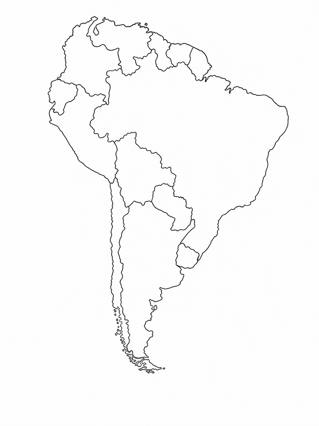
Blank Map of South America Outline Map

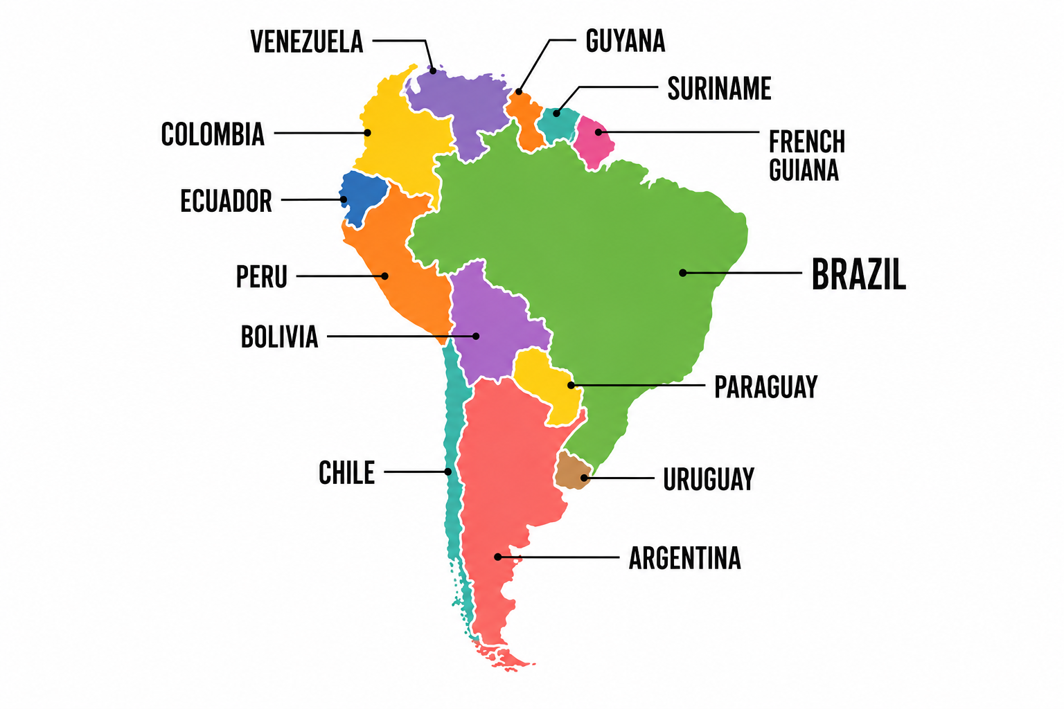
Map of South America

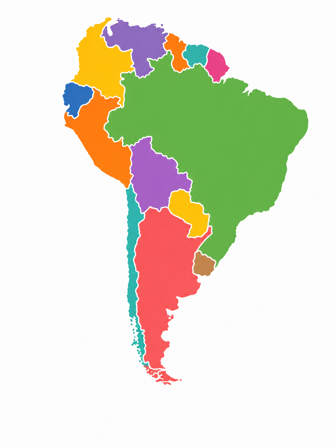
Blank Map of South America with Colour

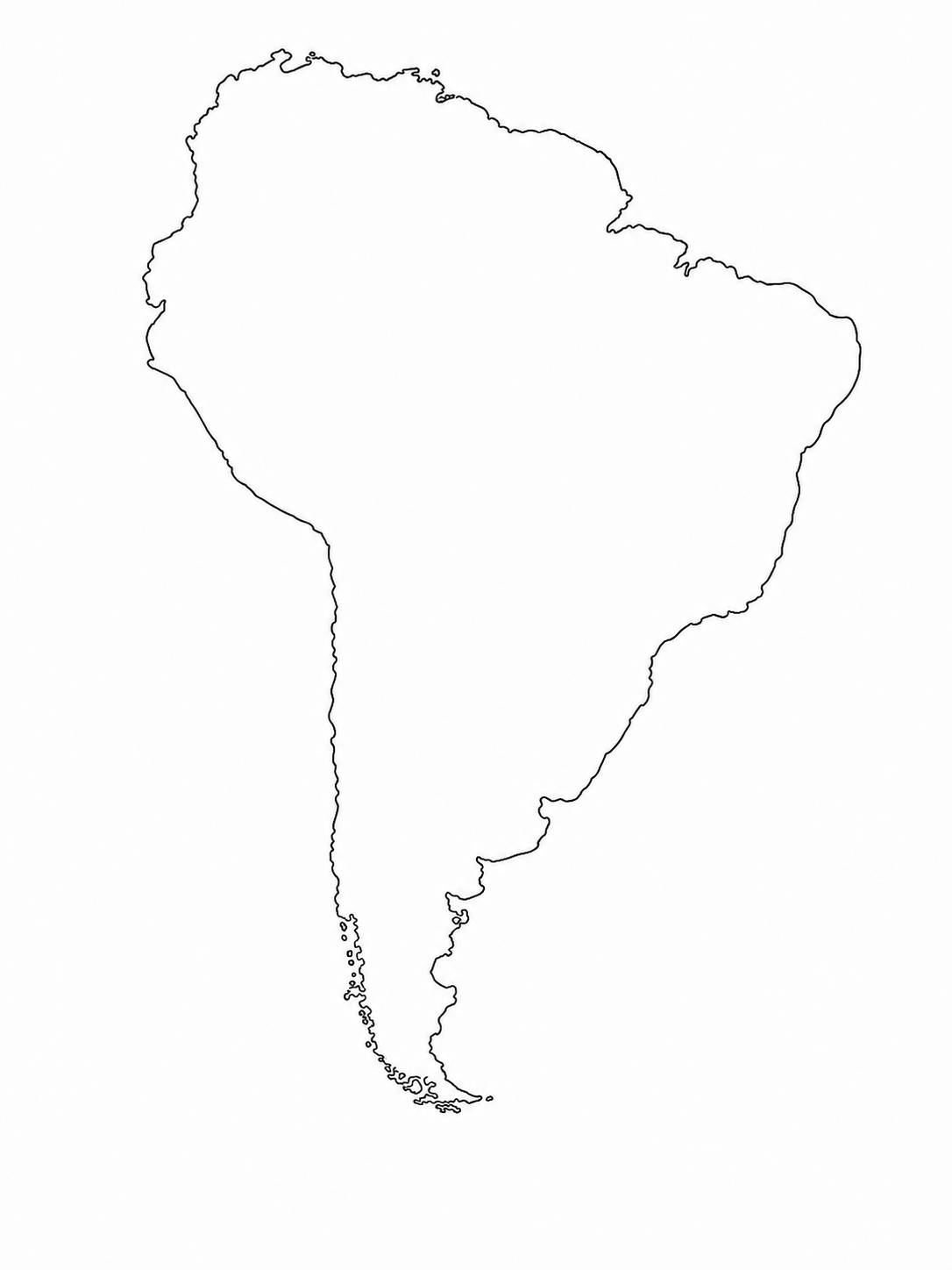
Blank Map of South America Without Country Boundaries

Also see: Blank Map of Georgia, USA
What is a blank map of South America?
A blank South America map is a map of the continent without country names, capital names, labels, or extra markings. Some versions show only the outer coastline. Others show country borders so students can label each country.
A South America outline map usually shows the shape of the continent and may include internal borders. A South America map without labels gives learners a clean space to identify countries, capitals, oceans, mountain ranges, rivers, and regions by themselves.
For classroom use, the best option is usually a blank map of South America with countries. This means the country borders are visible, but the names are removed. Students can write the names directly on the map, use it as a quiz sheet, or later compare their answers with a labeled map.
Countries to label on a blank map of South America
Most classroom worksheets focus on the 12 sovereign countries of South America:
- Argentina
- Bolivia
- Brazil
- Chile
- Colombia
- Ecuador
- Guyana
- Paraguay
- Peru
- Suriname
- Uruguay
- Venezuela
Some maps include territories or nearby areas, such as French Guiana or the Falkland Islands. This depends on the map source and the purpose of the worksheet. For example, says its map covers 12 countries, while another section lists 14 entries including French Guiana and the Falkland Islands. That makes one thing clear: check the map before printing an answer key.
Also see: Midwest Region Blank Map
Best formats: PDF, PNG, or SVG?
The right file type depends on how you plan to use the map.
PDF: Best for printing. A blank map of South America, a PDF or a printable South America map, is the easiest choice for teachers, students, and parents. You can download it, open it in a PDF viewer, and print it on A4 or US Letter paper.
PNG: Best for slides, Word documents, Google Docs, and quick digital use. A PNG is easy to insert into a worksheet, presentation, or online lesson.
SVG: Best for editing. SVG files can be opened in tools such as Illustrator, Inkscape, or Figma. They are useful when you want to change colors, add labels, resize the map, or build a custom classroom resource. Ultimaps lists PNG, SVG, and PDF versions and explains that PDF works for direct printing, PNG works for presentations, and SVG works for editing.
For a simple worksheet, choose a blank map of South America in a printable PDF. For a custom design, use SVG.
Also see: Printable Blank Northeast United States Map
Types of blank South America maps
A single map style will not fit every lesson. Different map types work better for different tasks.
Basic blank map
A basic free blank map of South America shows the continent and country borders without labels. Use it for country-name practice, quick quizzes, and homework.
South America outline map with countries
A South America Outline map with Countries shows the country boundaries but leaves the names blank. This is the best version for labeling exercises.
Labeled answer key
A labeled map is useful after the quiz. Students can compare their answers with the correct country names. We provide both labeled versions that can be used as reference maps or answer keys.
Colored map
A colored version separates neighboring countries visually. This is useful for younger students who struggle to see borders clearly.
Blank map of South America with cities
A blank map of South America with cities adds major city points or capital locations. Use it for travel projects, country-capital practice, and presentation work.
Map with grid lines and scale
Some educational maps include latitude and longitude lines, a scale bar, and a projection note.
That kind of map is better for older students because it supports distance practice, coordinate reading, and map interpretation.
How to use a printable blank map of South America
A printable blank map of South America can be used in more ways than a simple country-labeling test.
Start with country names. Ask students to label all 12 countries from memory. Then give them a labeled map and let them correct their own work.
Move to the capitals. Students can add Brasília, Buenos Aires, Santiago, Lima, Bogotá, Quito, Caracas, Montevideo, Asunción, La Paz, Sucre, Georgetown, Paramaribo, and other capital references depending on their grade level.
Add oceans and major physical features. Students can label the Atlantic Ocean, Pacific Ocean, Andes Mountains, Amazon River, Amazon Basin, Atacama Desert, and Patagonia.
Use a quiz format. A Blank Map of South America quiz works well when students need timed practice. Homemade Gifts Made Easy includes quiz sheets and answer sheets for South America map practice.
Use it for review. Print one blank version and one labeled version. The blank sheet becomes the worksheet. The labeled sheet becomes the answer key.
Teaching tips for better map practice
Students learn the map faster when the work is broken into smaller sections. Trying to memorize all countries, capitals, oceans, and physical features at once can become frustrating.
A better order is:
- Label the 12 countries
- Add capitals
- Add oceans and borders
- Add major rivers and mountains
- Review using a blank quiz sheet
We suggest learning the map in pieces, turning practice into games, using team activities, and combining geography with subjects like history, spelling, biology, and ecology.
For younger students, use coloring. Ask them to color each country a different shade, then write the name inside or beside the country. For older students, use map comparison. Ask them to compare population, language, climate, or major exports by country.
South America, Latin America, and Central America: choose the right map
Search terms can be confusing here.
A blank map of South America covers the South American continent. A Blank Map of Central and South America printable covers a larger region. A blank map of South America and Central America is useful for Spanish class, Latin America lessons, Hispanic Heritage Month activities, and country-capital practice across a wider area.
A Latin America map is broader again. It may include Mexico, Central America, the Caribbean, and South America. Our other map PDF is titled “Latin America” and shows a wider regional blank map rather than a South America-only worksheet.
For a South America-only quiz, use a South America-only outline map. For an Americas unit, you may also pair it with a North America outline map or a Central America map.
Free printable maps vs stock map graphics
A free printable South America map is usually best for schoolwork, homeschooling, and study practice. These maps are made for printing, labeling, and classroom use.
Stock map graphics are different. Adobe Stock and Shutterstock list large collections of South America map images, vectors, and illustrations for commercial design, presentations, reports, posters, and marketing graphics. Adobe Stock shows more than 217,000 results for “South America map,” while Shutterstock lists more than 190,000 South America country map stock photos, vectors, and illustrations.
Royalty-free does not always mean free. It usually means the file can be used under a license after download or purchase. For school worksheets, free printable PDF sources are simpler. For commercial design, check the license before use.
License checks before downloading
Map licensing varies by website.
Our maps are free for personal, commercial, educational, publication, website, digital, and printed use, with attribution required if the attribution mark is removed.
Our South America maps are public domain/CC0, with no signup, watermark, or attribution required.
Wikimedia Commons has a category for blank maps of South America, including SVG maps, political maps, grid maps, and country-specific blank maps. Each file has its own license on its description page, so check the individual file before publishing or redistributing it.
Some printable sites limit use to personal, educational, and non-commercial purposes. Our Institute says its PDF can be printed for personal, educational, and non-commercial use.
Quick guide: which South America map should you choose?
Choose a blank map of South America PDF when you need a worksheet for printing.
Choose a blank South America map printable when students need to label countries by hand.
Choose a simple map of South America when the worksheet is for younger learners.
Choose a printable map of South America with country borders when you want a map quiz.
Choose a South America map printable with labels when you need an answer key.
Choose an SVG when you want to edit the file or add custom labels, icons, routes, or colors.
Frequently Asked Questions – Blank Map of South America
What is the best blank map of South America for students?
The best option is a black-and-white map with country borders and no labels. It saves ink, gives students space to write, and works well for quizzes.
Can I download a blank map of South America in PDF?
Yes. The blankusmap.com website provides a Blank map of South America in PDF or a printable PDF version. PDF is best when you want a clean worksheet that prints without editing.
What is the difference between a blank map and an outline map?
A blank map usually has no labels. An outline map may show the coastline and country borders. In many school resources, both terms are used for similar worksheets.
What countries should students label on a South America map?
Students usually label 12 countries: Argentina, Bolivia, Brazil, Chile, Colombia, Ecuador, Guyana, Paraguay, Peru, Suriname, Uruguay, and Venezuela.
Can I use a blank map of South America for a quiz?
Yes. A Blank map of South America quiz is one of the best uses. Print the blank version for students and use a labeled version as the answer key.
Where can I find a free blank map of South America?
You can find free options from educational printable sites, map libraries, Wikimedia Commons, Blankusmap.com, and similar sources. Always check the license before publishing or using the map commercially.
Should I use a South America map or a Latin America map?
Use a South America map for the continent only. Use a Latin America map when the lesson includes Mexico, Central America, parts of the Caribbean, and South America.
Final Conclusion
A blank map of South America makes geography easier to practice, teach, and remember. Whether you need a printable PDF for a classroom quiz, a simple outline map for labeling countries, or an editable version for a project, the best map is the one that matches your purpose. Choose a clean, accurate format, check the usage rights, and use it to build a clearer understanding of South America, one country at a time.