
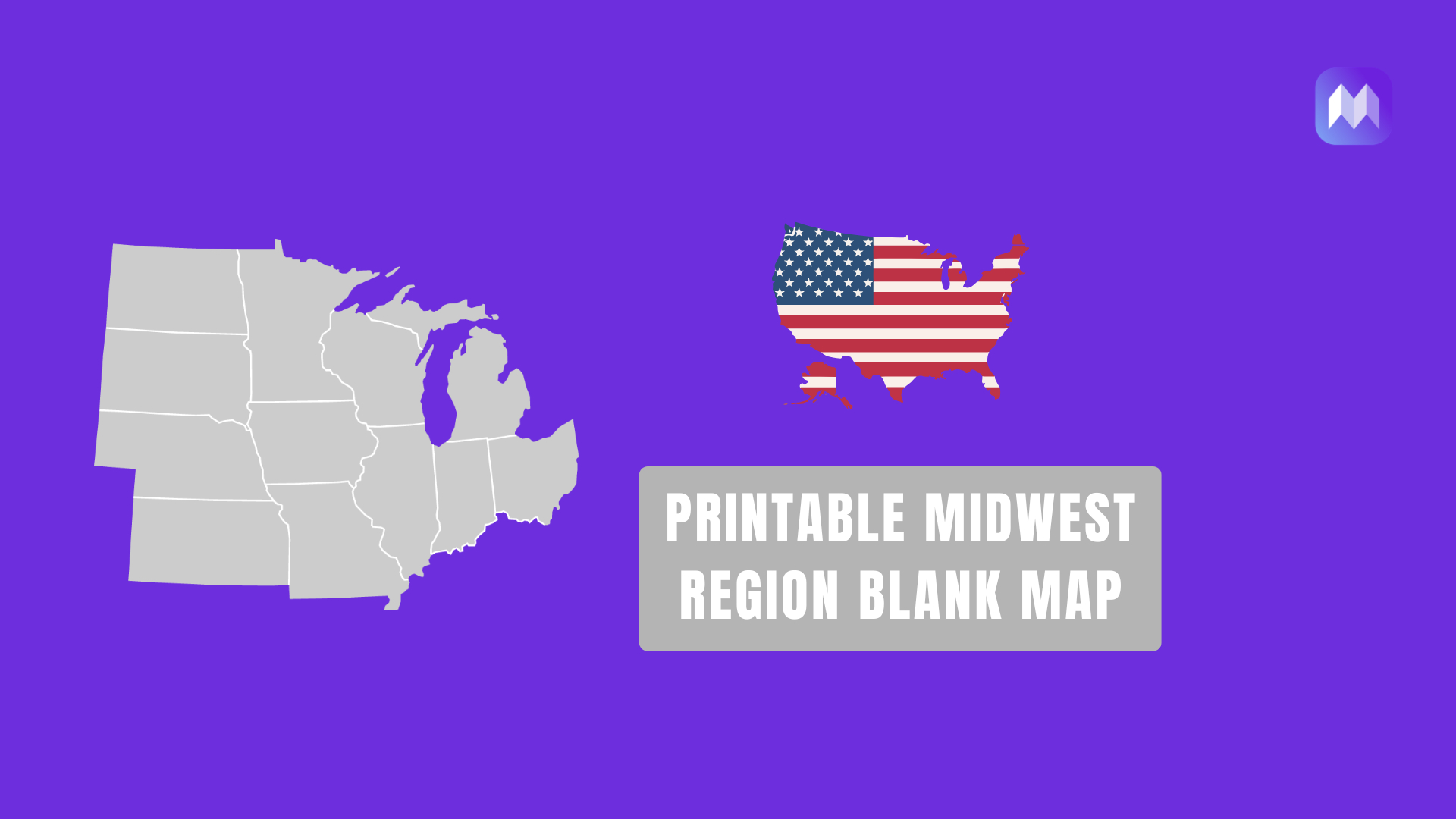
A Midwest Region Blank Map is one of the most useful resources for students learning U.S. geography. Whether you’re studying the Midwest states, preparing for a geography quiz, creating classroom activities, or teaching regional geography, a printable Midwest map provides a simple and effective learning tool.
Many teachers and homeschool parents prefer blank regional maps because they encourage active learning. Instead of simply reading state names from a textbook, students can identify, label, color, and memorize Midwest states while developing a stronger understanding of the region’s location and geography.
This printable map helps users identify Midwestern states, locate major cities, and better understand regional geography.
It can be used for educational worksheets, map labeling exercises, business planning, travel tracking, and research projects.
On this page, you’ll find a high-quality blank Midwest map along with useful information about the region, its states, and its major cities.
Midwest Region Blank Map (Printable Map)
Midwest States Blank Map Printable

Midwest region blank map with capitals

Also see: Printable Blank Northeast United States Map (Free PDF, PNG & SVG)
What Is the Midwest Region of the United States?

The Midwest is one of the four major geographic regions of the United States. Located between the Northeast, South, and Western regions, it is often referred to as the country’s agricultural and industrial heartland due to its rich farmland, manufacturing centers, and transportation networks.
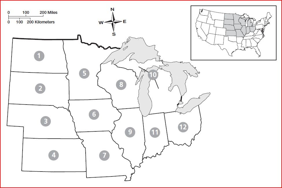
The United States Census Bureau generally recognizes twelve states as part of the Midwest Region:
- Illinois
- Indiana
- Iowa
- Kansas
- Michigan
- Minnesota
- Missouri
- Nebraska
- North Dakota
- Ohio
- South Dakota
- Wisconsin
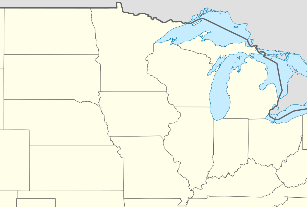
These states share many geographic, economic, and cultural characteristics. The region contains vast agricultural areas, major rivers such as the Mississippi and Missouri Rivers, and large freshwater resources, including portions of the Great Lakes.
Read More:- Printable Blank Northeast United States Map (Free
What Is a Midwest Region Blank Map?
A Midwest Region Blank Map is a map that outlines the Midwestern states without including labels or unnecessary geographic details. Depending on the version, it may show only state boundaries, state outlines, or additional features such as major rivers and lakes.
Unlike traditional maps filled with labels and symbols, blank maps focus on learning and customization. Students can write state names, identify capitals, color regions, or use the map for assignments and projects.
These maps are especially valuable because they allow learners to participate in the learning process actively. Research in geography education consistently shows that labeling and drawing on maps improves long-term retention compared to simply viewing completed maps.
Midwest Region Facts Sheet
| Category | Information |
| Region | Midwest United States |
| Number of States | 12 |
| Largest City | Chicago, Illinois |
| Largest State by Area | Minnesota |
| Population | Over 68 Million People |
| Major Industries | Agriculture, Manufacturing, Healthcare, Transportation |
| Largest Lake | Lake Superior |
| Major River | Mississippi River |
| Official Census Divisions | East North Central & West North Central |
Which States Are Included in the Midwest Region?
According to the U.S. Census Bureau, the Midwest Region consists of twelve states divided into two subregions:
East North Central States
- Illinois
- Indiana
- Michigan
- Ohio
- Wisconsin
West North Central States
- Iowa
- Kansas
- Minnesota
- Missouri
- Nebraska
- North Dakota
- South Dakota
These states form the heartland of the United States and play an important role in agriculture, transportation, manufacturing, and commerce.
Because definitions sometimes vary, some educational resources may include nearby states differently. However, the twelve states listed above are the official Midwest states recognized by the Census Bureau.
Why Use a Printable Midwest Region Blank Map?
Printable regional maps provide a practical way to learn geography without relying entirely on textbooks or digital tools. Teachers frequently use Midwest maps for classroom worksheets, quizzes, and assessment activities because they encourage students to interact directly with the material.
Homeschool families also benefit from printable maps because they are flexible and easy to incorporate into daily lessons. Children can label states, identify capitals, color different regions, and track historical events using the same map.
For older students, blank maps can support research projects involving agriculture, population distribution, climate zones, transportation systems, natural resources, and economic development across the Midwest region.
Educational Benefits of Midwest Blank Maps
Blank maps help transform geography from a memorization exercise into an active learning experience. When students write state names themselves, they develop stronger recall and improve their understanding of regional relationships.
Many educators use Midwest maps to teach:
- Midwest state locations
- State capitals
- Major rivers
- Great Lakes geography
- Agricultural regions
- Population centers
- Historical migration patterns
The process of labeling and studying maps also improves spatial thinking skills, which are valuable in subjects such as history, environmental science, economics, and social studies.
Different Types of Midwest Region Maps
Not every map serves the same purpose. Depending on your needs, several versions may be available.
Blank Midwest States Map
This version contains state boundaries without labels and is commonly used for geography practice and classroom assignments.
Midwest Map With State Names
These maps display state names and are useful for beginners who are still learning the geography of the region.
Midwest Outline Map
An outline map focuses on the overall shape of the Midwest region and is often used for coloring activities, presentations, and educational projects.
Midwest Capitals Map
These maps highlight state capitals and are useful when studying government, history, and regional geography.
Midwest Physical Map
Physical maps show natural features such as rivers, lakes, plains, and elevation patterns across the Midwestern United States.
Common Uses of a Midwest Region Blank Map
A Midwest blank map can be used in many educational and professional settings.
Teachers use them for geography quizzes and classroom worksheets. Students use them to learn state names, capitals, and locations. Homeschool families incorporate them into regional studies and history lessons.
Researchers and content creators may also use Midwest maps for presentations, reports, demographic studies, travel planning, and educational materials. Because blank maps can be customized easily, they remain one of the most versatile geography resources available.
Final Thoughts
A Midwest Region Blank Map with Cities is a practical resource for students, educators, travelers, and professionals. It provides a clear view of the Midwestern United States while making it easy to identify states, major cities, and important geographic features.